
 Travel Agency
 Enquiry
Let’s Chart a Course: Nautical Charting Workshop
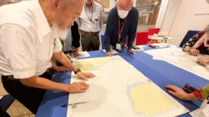
Nautical charts serve as maps of the sea, detailing water depths and coastal topography. Aboard the Pacific World, Japan Grace’s Onboard Representative draws on extensive maritime experience to manually plot the ship’s current position on a chart every single day. Today, a hands-on workshop on chart plotting was held for passengers. The session began with a short theoretical lecture, followed by practical practice where participants plotted actual sailing routes onto nautical charts. Using large drafting triangles and compasses, everyone focused intently on their work, meticulously mapping out each line with genuine enthusiasm.
PHOTO: Peace Boat